• Duration 2day(s)
  • Distance 112 km
  • Change in altitude (uphill) 923 m
  • Maximum altitude 653 m
  • Marked itinerary Yes

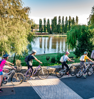
Welcome to Via Allier, the route of Véloroute 70, this route proposes you to discover the Puy-de-Dôme department along the Allier river.

The 112-kilometer route, from the Limagne plains to the north with his hilltop villages of the south of the department, is entirely marked out on low-traffic roads or cycle lanes.

We propose a presentation in five parts of about 20 km each for a touristic discovery.

Today, the Via Allier is entirely marked out on a shared road in the departments of Puy-de-Dôme and Allier. Gradually, the route is equipped with sections of greenways.

Opening dates and times

All year round.

Subject to favorable weather.

Services and equipment

Rubric :Sport
Activities :Cycling sports
Duration :2day(s)
Daily duration :7h00
Distance :112 km
Change in altitude (uphill) :923 m
Maximum altitude :653 m
type of itinerary :ALLER_ITINERANCE
Marked itinerary :Yes

Prices

  • Free access.

Contact for the route

Conseil départemental du Puy-de-Dôme - Mission Tourisme

Tel : 04 73 42 20 20

Email : tourisme@puy-de-dome.fr